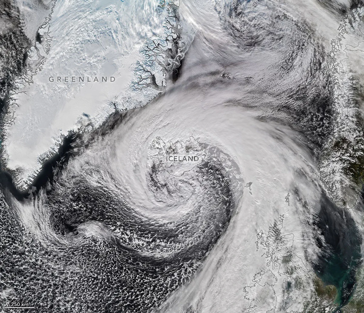
Earth Observatory Science Earth Observatory Extratropical Cyclone Whips… Earth Earth Observatory Image of the Day EO Explorer Topics All Topics Atmosphere Land Heat & Radiation Life on Earth Human Dimensions Natural Events Oceans Remote Sensing Technology Snow & Ice Water More Content Collections Global Maps World of Change Articles Earth Matters Blog Blue Marble: Next Generation EO Kids Mission: Biomes About About Us Subscribe 🛜 RSS Contact Us Search Hurricane Isaias—the only Atlantic hurricane to date in 2026—made landfall in Florida as a Category 2 storm on October 9. After delivering a rainy, windy blow to the U.S. Gulf Coast and drenching much of the Eastern Seaboard, the weather system had more in store. Riding the jet stream east over the North Atlantic, Isaias’s remnants developed into a powerful storm known as an extratropical cyclone. These low-pressure systems often feature asymmetrical, comma-shaped cloud patterns and can strike with hurricane-force winds, rain, and blizzard-like conditions. The VIIRS (Visible Infrared Imaging Radiometer Suite) on the NOAA-21 satellite captured this image of the extratropical cyclone brushing past Iceland on the afternoon of October 1
Log in or sign up to comment.